All ABOUT CAR
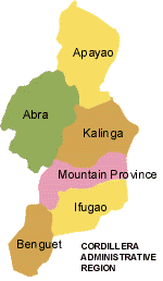
Benguet, together with Abra, Apayao, Baguio City, Ifugao, Kalinga, and Mountain Province comprise the Cordillera Administrative Region (CAR) in Northern Luzon. It has a mountainous terrain of peaks, ridges and canyons; and a temperate and generally pleasant climate.

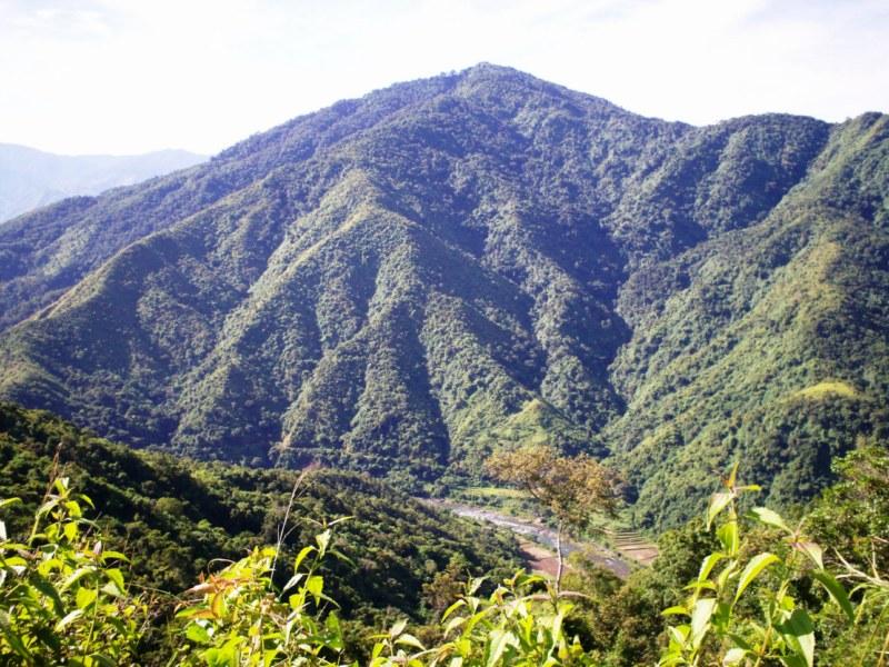
BENGUET

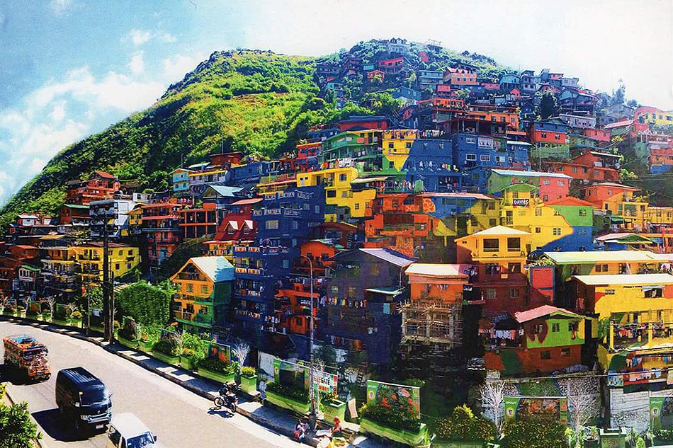
LOOK: Benguet houses turned into colorful mural. Retrieved from http://sa.kapamilya.com/absnews/abscbnnews/media/news-special1/lifestyle/6/21/benguet-mural-department-of-tourism-062116.jpg 2017 April 27 Retrieved

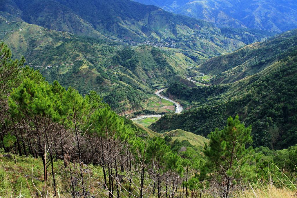
Guia, J. (2007).Gaze at the Alluring Beauty of Benguet. Retrieved from https://www.vigattintourism.com/assets/tourist_spots_photos/optimize/1351056387bpYHfLyb.jpg 2017 April 27 Retrieved
Benguet lies southernmost in the Cordillera Administrative Region. It is geographically located between 16’33” north latitude and 120’34” to 120’52” east longitude. On the north, it is bounded by Mountain Province, on the south by Pangasinan, on the east by Ifugao and Nueva Viscaya and on the west by La Union and Ilocos Sur.
The province comprises one (1) congressional district, tw0 (2) provincial board district, thirteen (13) municipalities and one hundred forty (140) barangays. It has three major ethnolinguistic groups: the Kankana-eys, Ibalois and Kalanguya and other minor groups with distinct cultures and histories of their own.
The name Benguet was first pronounced in La Trinidad, a thriving settlement at the crossroads to the lowland trading sites during the period of Spanish expeditions. La Trinidad then was a settlement around a lake alive with wildlife, wallowing carabaos dotted with patches of taro, rice, gabi and camote. In one expedition, a curious Spanish conquistador who saw this settlement noted that the people wore cloth coverings wrapped around their head several times. When he inquired about it, the native explained that the heavy head covering which the people wore as protection from the searing cold and winds is termed “benget”. With the western accent of the colonizers “benget” was mispronounced as “benguet”. In time, it eventually became a general reference to the territories of the Iggorotes peopled by the Ibaloi, Kankanaey, Kalangoya, and other minor tribes.
KALINGA

KalingaRetrieved from https://spiritedthoughts.files.wordpress.com/2010/11/kalinga-007.jpg 2017 May 3 Retrieved
The name "Kalingga" is believed to have been derived from the Ibanag word "kalinga" and the Gaddang word "kalinga", both meaning headhunters. The Spaniards picked up the term because of their headhunting tradition, and the Americans followed suit. The Kalingas have numerous songs, such as the salidummay, the dong-dong-ay, the oggayam, the ading, the wasani, the paliwat, the owawi, and the dandanag. But its enduring and distinct rite is the "Bodong" that has become an institution for peace up to this day. Kalinga is classified according to bodong-holding groups or ili, or sub-tribes, namely the Tinglayans, the Lubuagans, the Tanudans, the Pasils, the Balbalans, the Pinukpuks, and the Tabuks. (Source: Igorot, the Cordillera Schools Group.)
The Province of Kalinga, is a landlocked province of the Philippines in the Cordillera Administrative Region in Luzon. Its capital is Tabuk and borders Mountain Province to the south, Abra to the west, Isabela to the east, Cagayan to the northeast, and Apayao to the north. Prior to 1995, Kalinga and Apayao used to be a single province named Kalinga-Apayao, until they were split into two to better service the needs of individual native tribes in the provinces.
There are many sub tribes in the province. The strong sense of tribal membership and filial loyalty results in frequent tribal unrest and occasional outright war. Due to the mountainous terrain and warrior-culture of the people, the Kalingas were able to maintain their culture despite the attempted occupation of the Spaniards, Japanese, and Americans. Unknown to many, the last stand of President Emilio Aguinaldo, the first president of the Philippines was in this province, in Lubuagan, which he proclaimed the national capital , and where the Aguinaldo Museum commemorates him and those events.
The Kalinga people are the most extensive rice farmers of the Cordillera peoples, having been blessed with some of the most suitable land for both wet and dry rice farming. Like the Ifugaos, the Kalingas are one of the extensive terrace builders in the country. The Kalingas are also skilled potters with pot making concentrated in the lower Chico River Valley. They are also excellent in basketry, loom weaving and metal works.
MT. PROVINCE

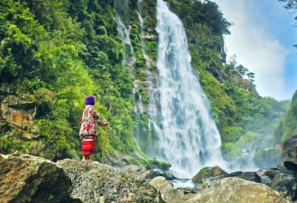
HIKERS' PARADISE:Mt. Province. Bomod-ok. Retrieved from http://media.philstar.com/images/the-philippine-star/headlines/20140804/Bomod-ok-Falls-Sagada-Mt-Province.jpg 2017 May 3 Retrieved
The history of the province is replete of intriguing past as many varied stories and circumstances were recounted by elders. Suffice it to say that the origin of the province has not been recorded. Spanish exploratory attempts to conquer Mountain Province were made between 1566 to 1665. Total subjugation of the area was never achieved throughout the three (3) centuries of Spanish rule because the fierce, warlike and hostile Igorots and formidable travel obstacles intimidated the Spaniards. Spanish occupation of some portions of the Cordilleras ended on September 3, 1899 when the Spanish headquarters in Bontoc was taken by Filipino forces. Some brave Igorots joined their lowland brothers in the fight against the Americans in 1898. After the establishment of the civil government during the American occupation in 1901, Mountain Province became a special province of the Philippines in 1907. Bontoc-Lepanto, Amburayan, Ifugao, Kalinga, Benguet and Apayao comprised the sub-provinces. Samuel Cane, the provincial supervisor, was appointed governor and Bontoc was made the capital town. In 1908, the old Mountain Province was created with seven (7) sub-provinces which later was merged into five (5) provinces: Benguet, Ifugao, Bontoc, Apayao, Kalinga (BIBAK). In 1967, the division of these five provinces gave birth to four (4) new provinces namely: Benguet, Ifugao, Kalinga-Apayao and Mountain Province. The sub-province of Bontoc retained its name Mountain Province and maintained Bontoc as its capital town. On March 25, 1967, Mt. Province became an independent province. Then President Ferdinand E. Marcos, appointed and inducted into office the first provincial officials. This new province came into operation on April 7, 1967, hence, this day is celebrated as Mountain Province Day. On June 15, 1987, Mountain Province became part of the Cordillera Administrative Region (CAR).
ABRA

CAR Cordillera Profile. Retrieved from https://www.vigattintourism.com/assets/images/photo_library/optimize/1348280799Gxy3MAFk.jpg 2017 May 3 Retrieved
Abra (Ilocano: Probinsya ti Abra; Filipino: Lalawigan ng Abra) is a landlocked province of the Philippines in the Cordillera Administrative Region in Luzon. Its capital is Bangued, and is bordered by Ilocos Norte on the northwest, Apayao on the northeast, Kalinga on the mid-east, Mountain Province on the southeast, and Ilocos Sur on the southwest.
The first inhabitants of Abra were the ancestors of the Bontocs and the Ifugaos. These inhabitants eventually left to settle in the old Mountain Province. Other early inhabitants were the Tingguians, or Itnegs, as they are also known. In 1598, a Spanish garrison was established in Bangued to protect Christian Ilocanos from Tingguian raids. Originally the area was called El Abra de Vigan ("The Opening of Vigan"). During the British Occupation of the Philippines, Gabriela Silang and her army fled to Abra from Ilocos and continued the revolt begun by her slain husband, Diego Silang. She was captured and hanged by the Spanish in 1763.
In 1818, the Ilocos region, including Abra, was divided into Ilocos Norte and Ilocos Sur. In 1846, Abra was created[3] as a political-military province with Lepanto as a sub-province. It remained so until the arrival of the Americans in 1899.
In 1908 the Philippine Commission once again in annexed Abra to Ilocos Sur in an attempt to resolve Abra's financial difficulties. On March 9, 1917, the Philippine Assembly re-established Abra as a province.
In 1942, the Japanese forces occupied the Philippines and entered Abra.
Abra was liberated by the Philippine Commonwealth forces and local Cordilleran guerrillas during the Battle of Abra in 1945, at the end of the Second World War.
The revolutionary Marxist priest, Conrado Balweg, who fought for the rights of the Cordillera tribes, began his crusade in Abra. After successfully negotiating a peace accord with Balweg's group in 1987, the Philippine government created the Cordillera Administrative Region, which includes Abra.
APAYAO

The Bridge had been covered with wood re-enforcement . Retrieved from https://blogger.googleusercontent.com/img/b/R29vZ2xl/AVvXsEhNbtvpc4LCEh31Nu82Z3QalH1hLdw35OVoKnGqW7CEJO5ryZKpbQCEuvB8sHaAeq85heF6lBs6Uvxe2O7Hoe29cXoL9NaipdQcxfBiKn0STAYRIM8gVzTzenK5NSlLbor1b0xwoTFsz87O/s1600/BU9A58671.jpg 2017 May 11 Retrieved
Available historical accounts show that Spanish missionaries first stepped in Apayao in 1608 where they established their foothold at the present day municipality of Pudtol. They found the Mandayas later known as Isnegs already in their organized communities. It was also on this year that Father Geronimo Molina started his missionary work in the province.
Towards the latter part of the 18th century, the Spaniards could only claim to have conquered the lower part of Apayao where they established their politico-militar commandancias. Evidence of this are the ruins of the Spanish churches at barangays Mataguisi and Emilia.
On June 18,1966, Republic Act No. 4695 was enacted creating four separate independent provinces namely: Benguet, Ifugao, Mt. Province and Kalinga-Apayao from the original Mountain Province.
When Executive Order No. 220 was signed and issued by Her Excellency President Corazon C. Aquino on July 15,1987, creating the Cordillera Administrative Region (CAR), the provinces of Ifugao and Kalinga-Apayao of Region 2 and Abra of Region 1 were included in the territorial coverage of the CAR.
In 1994, Congressman Elias K. Bulut filed a bill in congress for the possible separation of Kalinga and Apayao which on February 14, 1995, Republic Act No.7878 was signed into law. This Act provides for the conversion of the province of Kalinga-Apayao into regular province to be known as the provinces of Apayao and province of Kalinga, amending Republic Act No.4695.
As a new province, the Apayao Provincial Government has no buildings to house its offices. Hence, these offices are temporarily housed in privately owned houses in the poblacion of Kabugao, the capital town of Apayao.
The province has its own natural attractions not found in the rest of the region. It was the " Cordillera's Last Frontier for Nature Richness".
IFUGAO

Banaue Rice Terraces - Banaue, Ifugao. Retrieved from http://i1.trekearth.com/photos/35289/banaue_terraces.jpg 2017 May 3
Ifugao was formerly known as a part of the old Mountain Province. It was created as an independent province on June 18, 1966 by virtue of Republic Act No. 4695, otherwise known as the Division Law of Mountain Province. Under this Law, Mountain Province was divided into four provinces namely: Benguet, Ifugao, Kalinga Apayao, and Mountain Province. The word "Ifugao" means hill. The Spaniards changed 'pugo' to 'pugaw' and was finally changed by the Americans to "Ifugao". The province of Ifugao is a land-locked area located at the foot of the Cordillera mountain ranges. It is bounded by the high peaked mountain of Benguet in the western side, Nueva Vizcaya on the southern side, Isabela on the eastern side, and on the north by the protruding strip of the territory of Mountain Province. It is generally located at 120 degrees 40'17" longitude.
History of Benguet. Retrieved from http://www.benguet.gov.ph/index.php/profile/history 2017 April 26 Retrieved
Odan, H.B. (2013 February 12) History of Kalinga. Retrieved from http://aikahodan.blogspot.com/2013/02/history-of-kalinga.html 2017 April 26 Retrieved
History of Mountain Province. Retrieved from http://mountainprovince.gov.ph/the-province/history/ 2017 April 26 Retrieved
Abra Province: A Brief History. Retrieved from http://www.islandsproperties.com/places/abra.htm 2017 April 26 Retrieved
Apayao. Retrieved from http://www.visitmyphilippines.com/index.php?title=Apayao&Page=1&pid=625 2017 April 27 History of Ifugao. (2011 December 5) Retrieved from http://ifugaopost.blogspot.com/2011/12/history-of-ifugao.html 2017 April 26 Retrieved


No comments:
Post a Comment